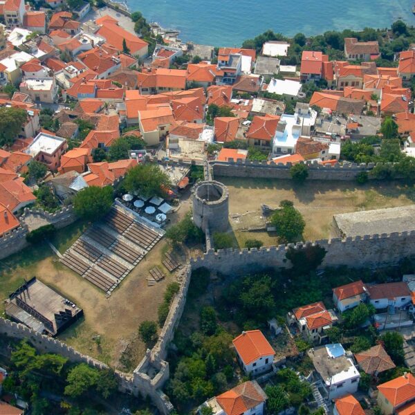
Coastal Wall

The coastal wall is the sea-facing part of Kavala’s historic fortifications, along the harbor of this city in northern Greece. Its stones have seen over 2,700 years of history, from the ancient Greek colony of Neapolis to the Byzantine and Ottoman eras, up to its current role as a promenade.

The first work to strengthen the fortress was carried out in 1425, during the hostilities between the Turks and the Venetians. The limits of the fortified city were extended to “run down” from its naturally fortified position, so as to include a flat piece of land next to the port. The walls of the town reflect the turbulent history of the 27 centuries of its continuous existence.

The largest section of the coastal wall dates to the period of 1520-1536. After the catastrophe of 1391 and thanks also to natural wear and tear, the new 16th-century walls were built over the ruins of the earlier historical phases.

Previous slide
Next slide

The Coastal Wall of Kavala follows the natural curve of the harbour along the seaward edge of the Panagia peninsula. Built mainly in the 16th century during the Ottoman reconstruction it incorporates earlier Byzantine and Classical fortifications beneath its stonework. The wall was designed to protect the upper town but also to enclose newly fortified ground near the waterfront, extending the city’s walls to the sea.

Made of local stone the wall has broad curtain segments, angled bastions and lookouts that follow the terrain. Though fortified it was also integrated with urban architecture – homes, warehouses and monuments were built against or into the wall especially during the Ottoman period. Today many sections remain intact and form a continuous architectural ribbon between the base of the old castle and the Kamares Aqueduct, with parts accessible on foot along a paved path. Its mix of military engineering and urban adaptation makes it one of the most beautiful features of old Kavala.

History & Culture

Previous slide
Next slide

Kavala’s history of fortifications goes back to the late 7th century BC when the Thassians founded the city of Neapolis on the Panagia peninsula. By the 5th century BC the city had granite walls and an acropolis. These walls served Neapolis during the Hellenistic and Roman periods as the city prospered along the Via Egnatia.

In the Early Byzantine period Emperor Justinian I reinforced the city, now called Christoupolis. Repairs continued into the 9th and 10th centuries but the city was heavily damaged when the Normans burned it in 1185. It was rebuilt and after another threat in 1302 Emperor Andronikos III ordered the construction of a new wall.

Despite all this Christoupolis fell to the Ottomans in 1391 after a long siege and the city was left in ruins. It was deserted until 1425 when a small fortress was built during the Ottoman-Venetian wars. Although the Venetians captured it briefly it was retaken.

Kavala’s true rebirth was in the 16th century under Sultan Suleiman the Magnificent. Between 1520 and 1536 the Ottomans built new walls over the old ruins extending the city walls down to the harbour. This coastal wall was the birth of the new city, now called Kavala and reflected its long layered history.

Local Interest

Today you can walk, cycle or just enjoy the views along the coastal wall of Kavala. The restored path runs along the top of the old stone wall, with the Aegean on one side and the old town of Panagia on the other. As you walk along the walls you can see several historic monuments embedded in the fortifications.

Map

VISIT

Coastal Wall

Opposite the car park of the Kavala Customs House
65302 Kavala

Kavala Fortress

One of the most prominent places of the city is its acropolis.
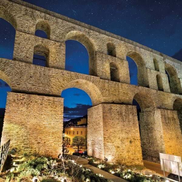
Old Aqueduct

The most characteristic monument of Kavala is the large, arched aqueduct, known by the name “Kamares” (Arches).

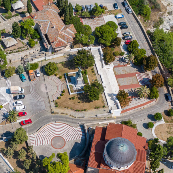
Mohammed Ali's Square

The square was formed in 1931 – 1934, in order to place the statue of Mohammed Ali.
Facebook
Twitter
LinkedIn
Pinterest